Below is a list of sites where butterflies are regularly seen in Norfolk.
Burnham Overy Dunes/Gun Hill - part of the Holkham Estate - Map
Reachable from either Burnham Overy Staithe car park (TF844443) or a small unofficial parking area on the A149 east of the town. Please note the car park may flood on high tides.
To reach the dunes a walk of about half an hour is involved along a seawall, part of the Norfolk Coast Path leading to a boardwalk.
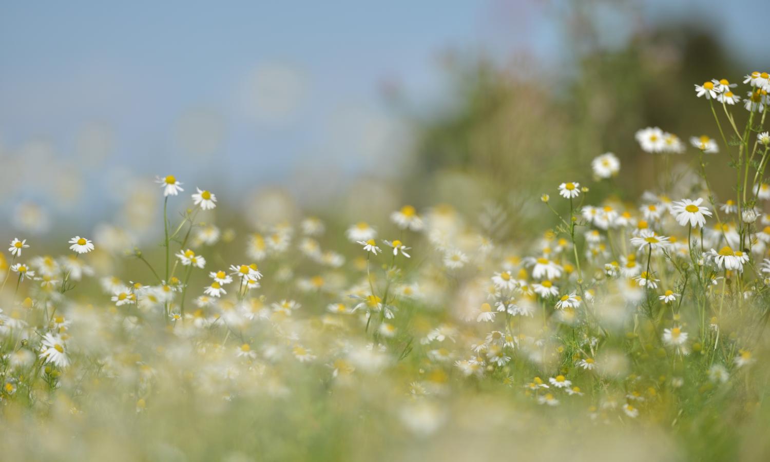
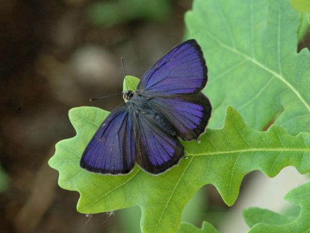
The main butterfly interest is on the south side of the dunes around Gun Hill to the left of the end of the boardwalk. This area has extensive patches of wild privet providing a food source and shelter in otherwise exposed conditions.
Species here can include Dark Green Fritillary in July, Grayling in August and Brown Argus in May/June or August amongst commoner species. Similar species can be found throughout the dune system but care must be taken not to degrade this internationaly important habitat.
The area is also well known for migrant and breeding birds.
Buxton Heath - Map
Managed by NWT in conjunction with the Buxton Heath Wildlife Group. Access to the site is open. To the North of the Heath is the Great Wood which is managed by the Forestry Commission
http://buxtonheath.weebly.com/
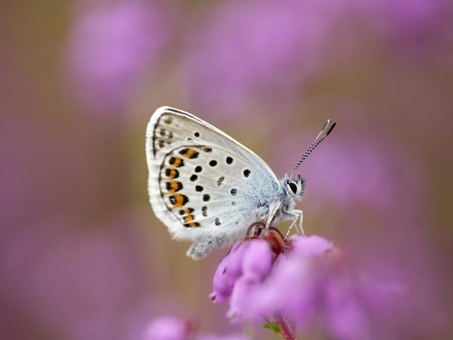
Apart from being an excellent site for Silver-studded Blue, the Heath is home to many interesting plant species e.g. Marsh Gentian and Common Butterwort
The Heath is just to the East of the B1149, one mile north of the Marsham Arms pub. There is a small finger post signed to Buxton Heath on the B1149 at the junction. Turn off the B1149 at the junction, then about 200 yds on the left there is a track down to a car park (TG172214).
The main target species are Silver-studded Blue (usually flying in last two weeks of June and the first week of July) and White Admiral, again at the end of June. Both are to be found up in the NW corner of the site. Take the main track up the western edge of the site to the top NW corner. There is a gate through into the Forestry Commission area which can be a good place for White Admiral. The track along the north of the Heath, heading East has heather lawns where the Silver-studded Blues can be seen. They are also present on the heather along the equivalent ride on the north side of the boundary in the Forestry Commision area.
Catfleld Fen - Butterfly Conservation Reserve - Map
Walk from the sluice gate along the bank just outside the reserve heading south is best as Swallowtails cross this bank between Barton Broad Great Fen and Catfield Fen
Take the small road marked Fenside and park at the Staithe TG 367 214.
Foulden Common
- Walk down the track to the Common entrance and follow the main path up the centre of the Common.
- On the right there are a series of grassy bays between scrub, and these bays are a good place to find both Dingy and Grizzled Skippers.
- A particularly good area has traditionally been around the water-level measuring station on the right hand side of the main path.
- You should also see Green Hairstreak and Brimstone on the Common.
Directions
- There is a small parking area at TF7640 0003.
- From Mundford, take A134 (Downham Market road) then right to Foulden, past Didlington Hall and left into Foulden village.
- Drive through the village to a T-junction and turn left towards Oxborough.
- After the road bends round left there is a small pull-off on the left at the entrance to the Common.
Foxley Wood - Norfolk Wildlife Trust - Map
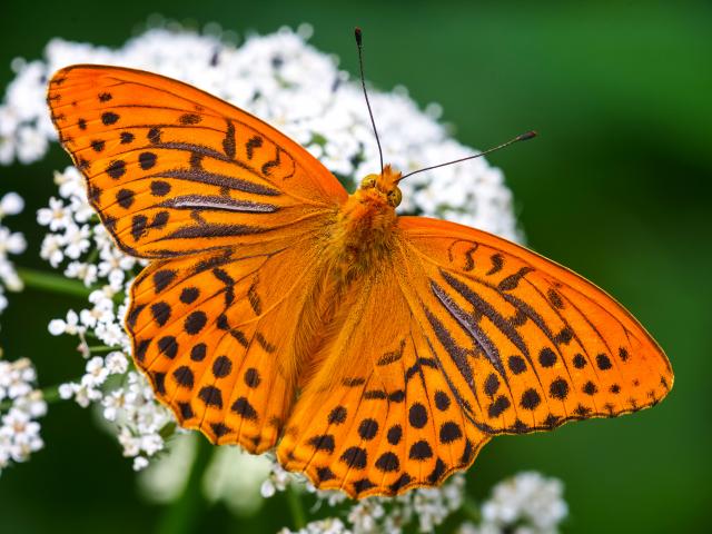
At over 300 acres, Foxley Wood is largest remaining block of ancient broadleaved woodland in Norfolk, thought to be at least 6000 years old and listed in Doomsday Book. Norfolk Wildlife Trust have restored the site from former neglect and largely removed introduced conifers. The main marked nature trail is good for a wide range of butterfly species. There is a well-established population of White Admiral and a recently returned breeding colony of Silver-washed Fritillary. In good weather both nectar on brambles (there is a good patch half way up the bluebell trail and just inside the glade on that side of the wood) and the fritillaries are especially fond of thistles. Areas of recent coppice alongside the nature trail, usually behind electric fences, can be good. One of the best Norfolk populations of Ringlet is present; the ride beyond the top of the bluebell trail is invariably good for them. Speckled Wood are scattered throughout the wood but try the darker side rides if they are not seen on the main open rides. There were a number of report sighting of Purple Emperor at Foxley Wood in 2019. Our last formal county record before the Purple Emperor’s extinction was in 1961 at Foxley Wood.
Located 2km NE of Foxley, 5km W of Reepham at TG049229, postcode NR20 4QR. Foxley village is on the A1067. At the sign 'Foxley, Village Hall, Foxley Wood' take the Themelthorpe road ('The Street') from the village. After 2km the reserve entrance and NWT board are clearly seen on the right. A vehicle barrier, max. height 2.175m (7ft), open 10.00-17.00 daily all year except Thursdays when closed all day. Drive through and follow signs to car parks. Free entry and parking. No dogs except guide dogs.
Grimes Graves - English Heritage Site - Map
An English Heritage site of Prehistoric Flint Mines (fee payable).
Visit on a warm, sunny day in May/June to see Dingy Skippers. These can be found in the dips and hollows behind the Information Centre.
Directions: Signposted off east A1065 north of Brandon. Postcode IP26 5DE Map reference TL815908.
Hickling Broad - Norfolk Wildlife Trust - Map
Approach via the A149 turning off to Hickling Green between Potter Heigham and Stalham. Walking trails start at the Norfolk Wildlife Trust's Warden's Office, Stubb Road TG428 222 (Sign posted from 'The Greyhound' in the village). A fee is charged to non Trust members.
Holkham Meals/Wells Woods - Holkham Estate - Map
An extensive shelter belt of conifers and mixed woodland most easily accessible from two Pay and Display car parks, at Lady Ann’s Drive (TF891440) or Wells beach (TF914454) off the A149 coast road. Part of the extensive Holkham Estate the mixed woodland along the southern edge of the pines provides a sheltered habitat for several species of butterflies. The stretch west of Lady Ann’s is particularly interesting with potential for various species including White-letter Hairstreak around elms in July near the Washington hide with Purple Hairstreaks (July/August) on oaks etc nearby, Brown Argus (May/June and August) and White Admiral (July), with the occasional Dark Green Fritillary in July/August wandering from the nearby dunes. These can often be found nectaring on extensive stands of hemp agrimony, particularly near the hide.
The eastern end, accessible from Wells beach car park tends to have less of interest generally but is still a popular walk.
These woods are nationally famous for rare migrant birds in autumn, but also attract migrating butterflies and dragonflies as well, so anything is possible.
Holt Country Park and Holt Lowes - North Norfolk District Council - Map
Car park (TG083375, Postcode NR25 6ES) situated just south of Holt off B1149, fee payable, public toilets, waymarked map provided.
These sites are connected and both have public access. The Country Park is owned by North Norfolk District Council and Holt Lowes is run by Trustees, both are managed for wildlife. Dogs are permitted but ponies graze on the Lowes so care is needed.
The Country Park has a good selection of common butterfly species but, in particular, is an excellent place in July to find White Admiral and Silver-washed Fritillary (including the unusual Valezina form). White Admirals have been here for a long time but the fritillaries only colonised in 2011. Check the buddleias in the car park area and walk the red/green path NW of the play area where the butterflies can be seen and photographed basking on the bramble in the sunny glades.
In August Holt Lowes is a good inland site to look for Grayling. Follow the yellow marked path to the pond and after the gate go straight on and walk the many trails around the heathland. Check the oaks for Purple Hairstreak.
Adders can be found on both sites so take care.
Keeled Skimmer is present on the ponds in the SE corner of the Lowes
www.northnorfolk.org/community/2261.asp
Horsey Gap - Map
Access from B1159 at Horsey Corner (TG460237), north of Yarmouth, south of Sea Palling. Park in area at end of track (pay and display) and walk south on inland side of dunes. Dark Green Fritillary can be seen on the bramble bushes in July; Grayling and Small Heath are also present.
Beware of adders; stout footwear recommended.
How Hill Environmental Centre - Map
- Access from A1062 east of Wroxham, north of Ludham.
- Free car park at TG372190.
- Good site for Swallowtails – check flowering shrubs around the perimeter of gardens.
- Walk NW across lawns and down cart track to Toad Cottage - nature trail is opposite. Take right hand fork close to starting gate to the meadow; pick a sunny day in June.
- A walk south along the River Ant flood bank can be very rewarding.
Kelling Heath - Map
Car Park (free) TG099418 on west side of Holt to Weybourne Road, north of Emcy’s Garden Centre.
The heath is part of a network of remnant heaths along the North Norfolk Coast. It is managed for wildlife by Heath Trustees and local volunteers. There is a network of paths across the heathland on both sides of the road.
The main butterfly interest is Silver-studded Blue which was translocated here in 2001. Although they can be found in the areas surrounding the car park, it is best to take the path north from the car park and turn right where the paths cross. This takes you towards the road and the Silver-studded Blues can be seen beside this path. After crossing the road follow the path to the level crossing, go over the crossing and turn left onto the short vegetation where more butterflies can be found.
Small Heath can also be found on this site as well as other common butterflies. Adders and ticks are present, so take care. It is safer to keep to the footpaths.
Martham Broad - Norfolk Wildlife Trust - Map
- Park in West Somerton TG469 200 and walk west along the south side of the Staithe to TG465 201.
- Here the public footpath heads south west and then north west around Martham Broad until eventually you reach the River Thurne.
- Look north for Swallowtails.
- It was here in 1985 the black form was seen.
Stoke Ferry Cut-Off Channel - Map
This channel was dug in the 1960s and brought the underlying chalk to the surface creating a chalkland habitat for both butterflies and plants.
- Search the canal slopes but take great care as the sides are steep.
- Walk to the right along the bank track and search on the canal slopes (take care not to slip as the Channel is very deep).
- Best area usually about 300 metres just after the trees.
- Generally a good area for most common butterflies at the appropriate time of year (17 species have been recorded on one day in May).
- Dingy and Grizzled Skippers can be found here in May/early June.
- A search of the high bank sides may yield Green Hairsteak (on the high bank to the right) and Brown Argus.
Directions
- Car Parking (free) TL696990 – access via Stoke Ferry village off A134 King’s Lynn-Thetford Road;
- Take School Lane south and park on grass area on right.
- There is a public access path over the rise going west along the bank towards the B1160.
Strumpshaw Fen - RSPB Reserve - Map
- Grid reference TG340 068.
- Easy parking.
- A fee is charged to non-RSPB members
Ted Ellis Nature Reserve, Wheatfen, Surlingham - Map
- Park in the car park at TG325 057.
- A map of the Reserve is available from the container outside the Warden’s office.
- Take the main path to the left of Wheatfen Cottage, then make a choice from the various paths which lead across the fen.
- Swallowtails can be seen throughout the Reserve, the first brood nectaring on yellow flag iris.
- There is no charge to visit the Reserve
- Donations are welcomed and envelopes for this purpose are provided outside the Warden’s office
Dogs are not permitted.
Warham Camp – Holkham Estate - Map
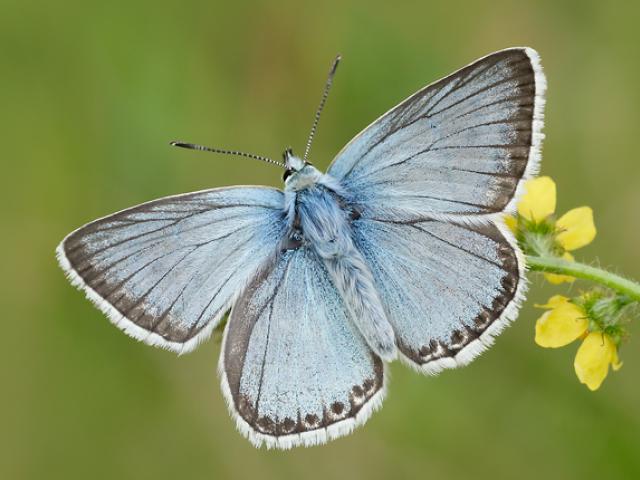
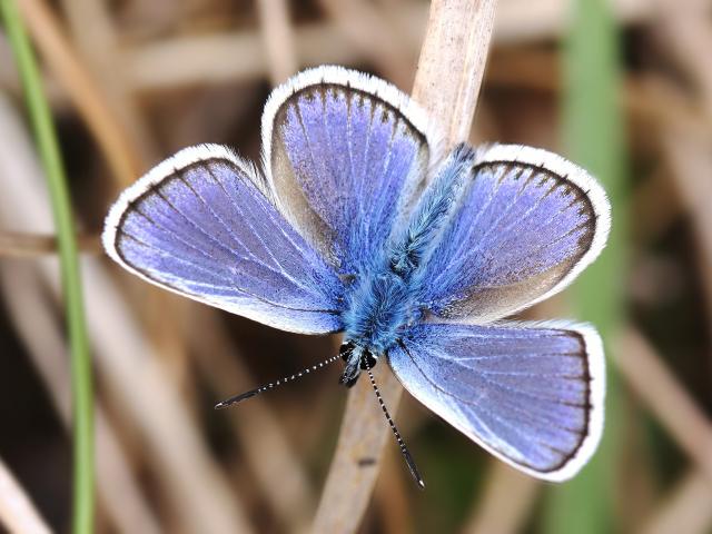
Warham Camp is a large and very well-preserved Iron Age fort sitting within the agricultural land, and is a scheduled monument. It is a circular structure with an overall diameter of 212m. The course of a channel of the River Stiffkey cuts across the southwestern edge of the earthworks, but this is an 18th-century alteration and the original river ran in a curve to the west. There are outer and inner ditches and banks which show exposed chalk with a characteristic flora, rare in Norfolk. Importantly this includes Horseshoe Vetch, the main food plant of Chalk Hill Blue. Almost certainly introduced to the site, nevertheless it is the northernmost colony in the United Kingdom and a visit in July/August can provide a spectacle of more than a thousand males swarming over the embankments and adjacent grassland and hedgerows. Brown Argus is also here in May/June and August as well as Common Blue.
Care needs to be taken at the site as the slope off the embankment can be steep.
Parking can be difficult as it is restricted to a wide verge on the approach road at TF947411. The fort is accessed by a wide track running west from an unnamed road south of Warham, which is itself on Stiffkey Road south of the A149 between Stiffkey and Wells.